
Say Goodbye To Costly Drone Re-Flights
Shuttermap lets you visualize your captured drone photos in a 3D map, so you can easily review them and fix any issues right on-site. When you’re done, head back to your office with complete peace of mind knowing you've captured everything you need, finally!
Reviewing Drone Photos Is A Hassle, We Fixed It!
No one enjoys scrolling through endless folders of photos after a long day in the field. Shuttermap lets you effortlessly manage and review a ton of photos in a breeze. See for yourself how easy it is!.


Upload UNLIMITED Photos
No project is too big! You can use Shuttermap to review tens of thousands of photos. Whether you're capturing a sprawling landscape or working on multiple projects a week, you never have to worry about storage limits.
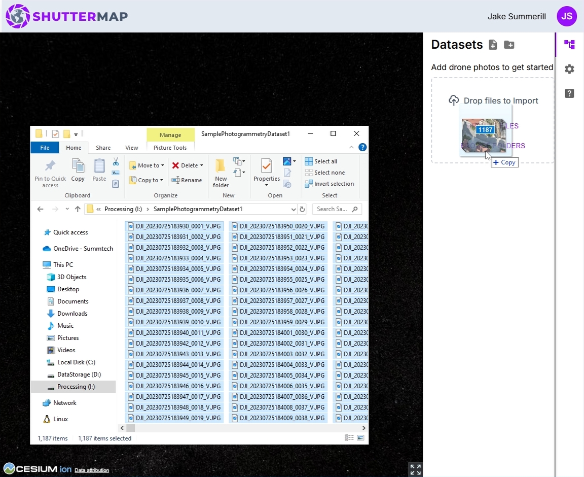
Add New Photos By Simply Dragging & Dropping
Spotted a mistake in your photos? No problem! Just retake the ones you need and drag and drop them right into Shuttermap.
Your Data Stays On Your Computer
Shuttermap analyzes your drone photos directly on your computer. This means your data stays private and secure – it never leaves your machine and only you have access to it.

Just What You Need To Simplify Your Workflow
(Not Everything Under The Sun)
Shuttermap is built to be simple and powerful, giving you the tools you need to streamline your workflow, fast. No time wasted learning complicated software, just a powerful tool that makes your life easier.
Effortless Import
Drag and drop hundreds or even thousands of photos at once.
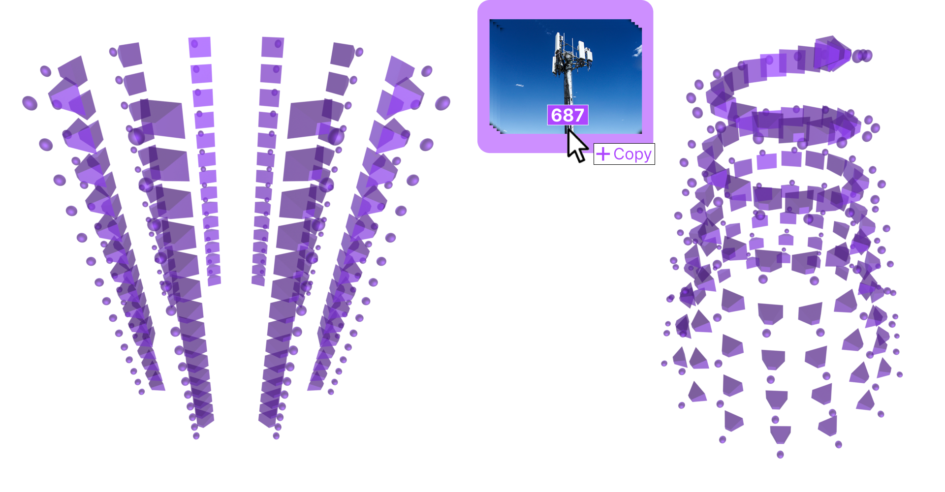
Seamless Review
See your photos in a spatial context for quick and easy quality checks.
Metadata Checks
Verify file integrity and ensure accurate metadata right on site, saving you time and headaches later..
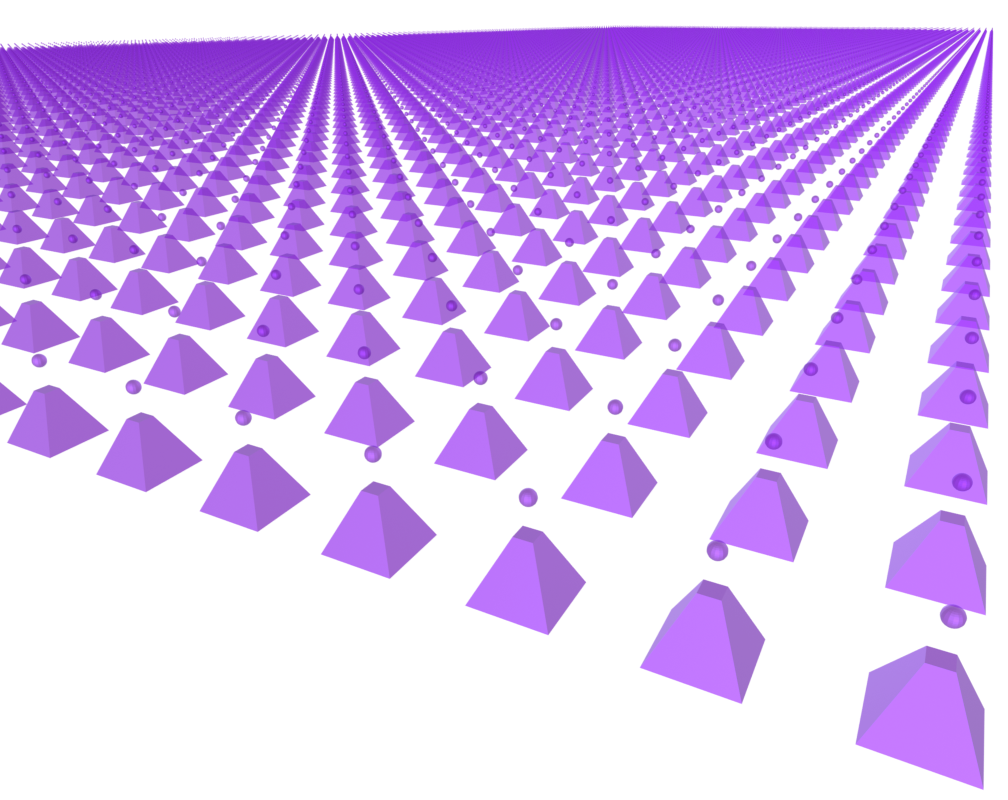
Satellite Map
Get a realistic 3D view of your work site, so you can easily understand the relationships between the photos and the actual landscape.
Lightning-Fast Performance
Shuttermap is designed for smooth operation and quick load times, so you can review your entire project without lags or slowdowns.
Safe & Secure
Your data stays on your computer, always. Shuttermap never stores your images–they're only accessible to you.
Frequently Asked Questions
- Monthly Plan for $15 per month. Perfect for trying it out and seeing the benefits for yourself.
- Annual Plan at just $12 per month (billed annually).
Less Expensive Than A Single Re-Flight
Access the beta version with a monthly subscription or save with our annual plan! Whichever you pick, rest assured it's less expensive than the travel and crew expenses of a single re-flight.
Shuttermap Is In Beta, And We're Building It With You!
Get in now and experience the future of drone data inspection. We're constantly adding new features based on user feedback and we welcome any suggestions you might have.